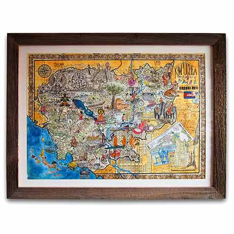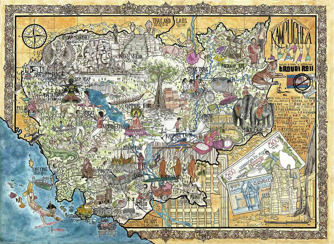
Cambodia map
Price range: 24,00€ through 50,00€
ABOUT SPECIAL REEDITION 2026 FOR HUMANITARIAN AID FUND
Pre-orders from France for shipping within France and worldwide (excluding Cambodia) can be placed here and will be dispatched in March 2026.
Thank you for your patience.
For those in Cambodia, here is the complete list of my partners where you can find the reissue of the map.
For a long time now, every year I’ve tried to contribute by donating a certain percentage of my work to NGOs or projects I truly believe in. The Cambodia map has been out of stock for several years, and I chose not to re-edit it for many reasons (some of you know why! ![]() ). However, the situation has changed with the expansion of the conflict along the Thai border, and I’ve decided to do a special re-edition to help refugee camps. Limited edition of 1,000 copies on 250 g paper, folded – 50 × 37.5 cm, hand-signed
). However, the situation has changed with the expansion of the conflict along the Thai border, and I’ve decided to do a special re-edition to help refugee camps. Limited edition of 1,000 copies on 250 g paper, folded – 50 × 37.5 cm, hand-signed
Press article to read here : Find Your News Media (EN) – Le Petit Journal du Cambodge (FR) – Cambodge Mag (EN & FR) – Cambodianess (EN)
More information on the distribution of humanitarian aid HERE


Related products


Illustration of the ORIGINAL map for sale HERE
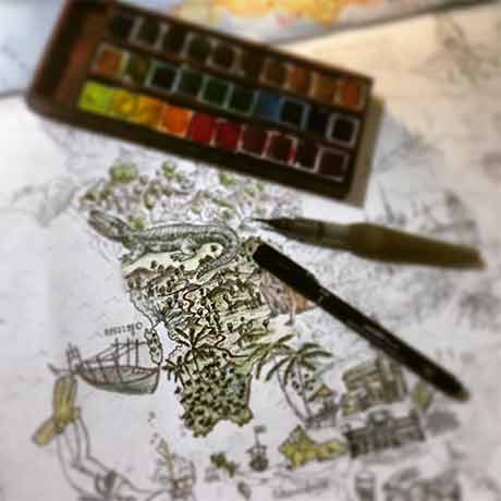
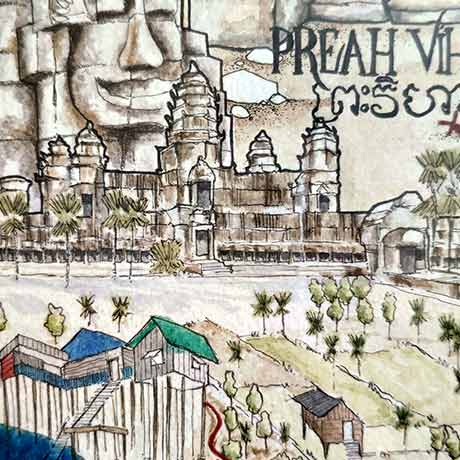
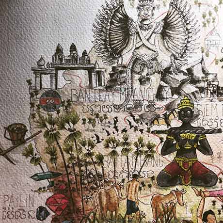
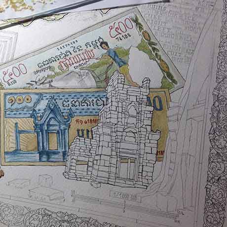
It is during the monsoon season of the year 2016 that the illustration of Cambodia in giant map was drawn. Several hours of meticulous work were necessary to compile a multitude of life atmospheres of the country. One evening, after a few Angkor beer I hid somewhere inside the drawing… in a very small place! Just look for a Westerner drawing in a roll, with a turban and red laces! If you look carefully, you’ll find 😉 Discover the wonders of Cambodia on this hand-made map. Several hours of meticulous work were required to compile a multitude of living environments specific to the country. Travel from the mountains of Ratanakiri to the Cardamoms range, cross over the Mekong and go through the floating villages of the Tonle Sap, take a rest on a Southern island, stroll around Battambang’s countryside, and don’t forget the mysterious ruins of Angkor temples… In a word, OPEN YOUR EYES! DISCLAIMER THIS MAP IS NOT FOR ORIENTATION BUT FOR DREAMING ONLY!